


Directions
Get directions between your address/position and any location on the map. Show locations within a specific distance of your location/address. Display routes and the directions steps.
Choose a starting point
Enter an address or

geolocate your position.
1.
Click to activate/deactivate the distance search.
2. (When activated) Use the slider to define the size of the search area.
3. Click on the button

to search.


Switch the travel mode.


Click on the marker popup to render the route and the directions steps.
 Directions
Click to toggle the directions steps widget.

Click to hide the directions steps widget.
Click to remove the currently displayed route and the directions steps widget.

Click to reverse the start point and the destination. This will update the route and the directions steps.

Click to center the map on your starting point.
Reset
Click to reset and search from scratch.
Submit location

Loading

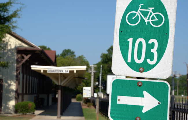

The perfect first stop on your trip to Cedartown is the Welcome Center located downtown just off the Silver Comet Trail. The popular cycling trail is marked in dark green on our maps and runs. 61.5 miles from Smyrna, GA to Alabama. The …
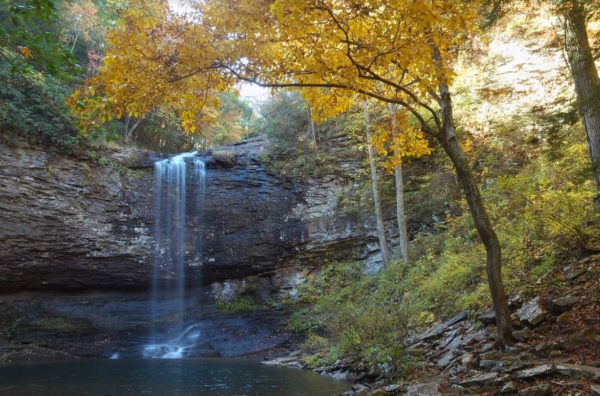
PLOT SUMMARY: 600 steps down into the canyon take you to two impressive waterfalls. That’s the easy part. The hike back to the top of the rim take a little more muscle. But the steps make it easier to stop and rest if needed. View Website
Location: Trenton/Rising Fawn (Dade County)
Trail Length: 1.5 Miles
Difficulty: Moderate to Strenuous …
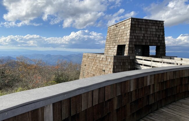
Visitors to Brasstown Bald in the Chattahoochee-Oconee National Forest enjoy 360-degree views of the Southern Appalachian Mountains from Georgia's highest point. When the weather allows, you can see four states from this one …
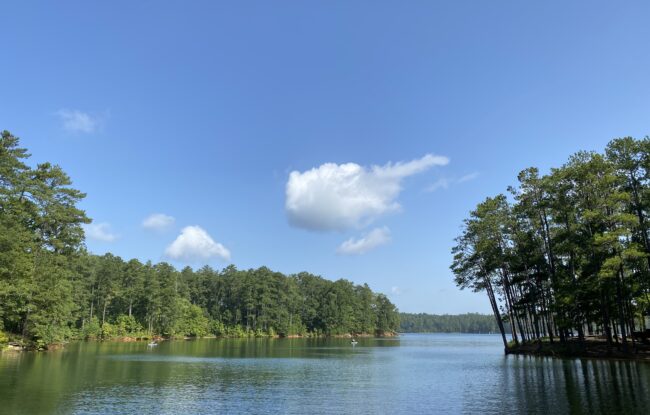
PLOT SUMMARY: Located on Lake Allatoona, Red Top Mountain State Park connects visitors to nature and history. This park is a popular location for swimming, water skiing and fishing. Visitors can bring their own boats or rent from nearby marinas. A sand swimming beach is nestled i…
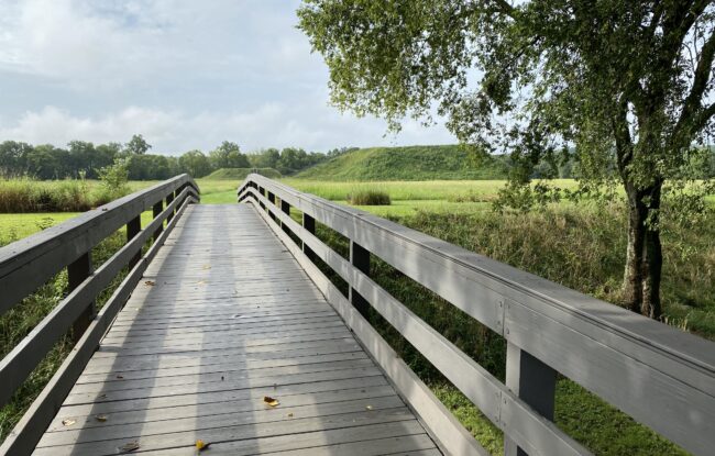
PLOT SUMMARY: On the outskirts of Cartersville you'll find this historic site, rich with Native American history. Etowah Indian Mounds Historic Site includes six large, earthen mounds covered in grass and accessible by large wooden staircases. From the tops of these mounds, visit…
PLOT SUMMARY: The Cartersville Farmer’s Market is held downtown, across from City Hall and next to the railroad tracks. While you're in Downtown Cartersville, you can browse through more than two dozen retail stores,…
PLOT SUMMARY: In the foothills of Northwest Georgia, you’ll find 80-acres of scenic farmland home to a variety of animals and a plethora of country fun. Pettit Creek Farms welcomes groups large and small to explore the grounds through daily tours and many seasonal events and cele…
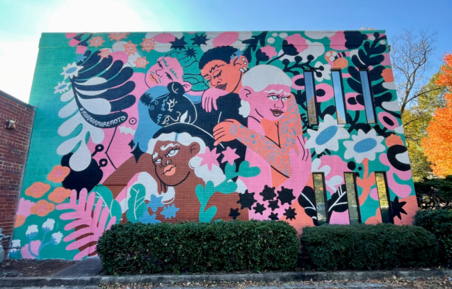
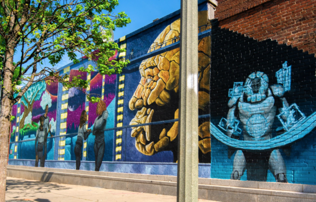
Artist: MAREMOTO PLOT SUMMARY: This mural is part of Living Walls Abroad: Nuevos Monumentos, an international exchange of artists between Atlanta …
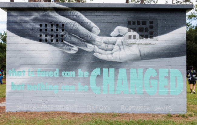
Artist: Tim Short PLOT SUMMARY: Living Walls envisions a world where public art acts as a social and economic engine, provi…

