PLOT SUMMARY: Northwest Georgia is known for it’s beauty and outdoor experiences from trails covered in tree canopies to beautiful waterfalls for social media moments. The 17 Hikes Challenge is your guide to great trails in all 17 counties of Northwest Georgia. Our counties offer unique experiences including historic Attractions, local Dining, one-of-a-kind Accommodations and nearby Hidden Gems when you discover each trail. The selection is designed to be a mix of rural and urban, easy to difficult, short to long. Explore something new and enjoy the outings!
How it works
- Register Now
- Review the list of 17 Trails on the challenge and plan your visits. The minimum distance per hike is 1 mile; distances and trail information are provided in each trail description below.
- 2023 challenge timeframe: Nov 15, 2022 to Dec 31, 2023
- List your hikes on the log sheet as you complete each one: Download Log Sheet (PDF)
- Email completed log sheet to: 17hikes@gmail.com
📸 Share the Fun
- Post your trail experience photo(s) to your social media pages
- Tag the Northwest Georgia’s Historic High Country Facebook page: @GAHighCountry
- Hashtag your posts: #17hikes #visitnwga #hikenwga


Directions
Get directions between your address/position and any location on the map. Show locations within a specific distance of your location/address. Display routes and the directions steps.
Choose a starting point
Enter an address or

geolocate your position.
1.
Click to activate/deactivate the distance search.
2. (When activated) Use the slider to define the size of the search area.
3. Click on the button

to search.


Switch the travel mode.


Click on the marker popup to render the route and the directions steps.
 Directions
Click to toggle the directions steps widget.

Click to hide the directions steps widget.
Click to remove the currently displayed route and the directions steps widget.

Click to reverse the start point and the destination. This will update the route and the directions steps.

Click to center the map on your starting point.
Reset
Click to reset and search from scratch.

Loading

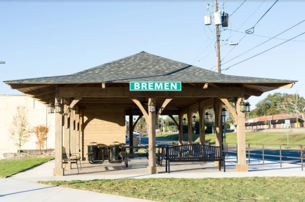

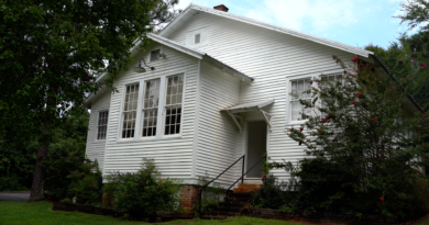
PLOT SUMMARY: A one mile walking tour for your health and history begins at City Hall. You will pass the Sewell Mill Textile Museum, and then continue around to some of the oldest homes still standing in Bremen. Bremen is also p…
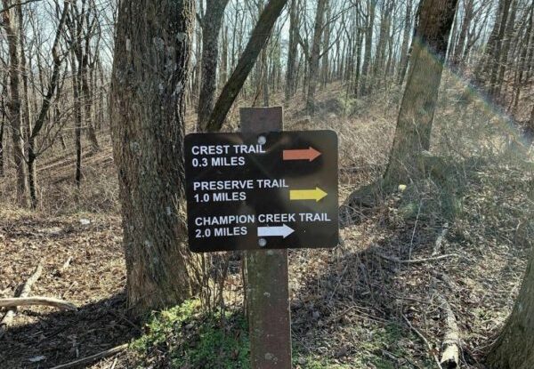
PLOT SUMMARY: This 900-acre preserve trail begins at 2500 ft elevation on Burnt Mountain. Two trails give the option of a short or longer hike. Parts of the trail follow old road beds. Seasonal flowers and interpretive signs hel…

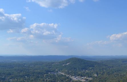
PLOT SUMMARY: The Stone Tower Loop is an uphill hike to the West Overlook Trail and returns on the CCC Stone Tower Trail. Enjoy year-round vistas from West Overlook and natural rock gardens. Several nearby trails are located in …
PLOT SUMMARY: Located off Highway 41, behind the Nazarene Church and State Patrol Barracks, the trail is named for the grave of George Disney who was buried atop Rocky Face Ridge. The Disney Trail is noted as being one of the mo…
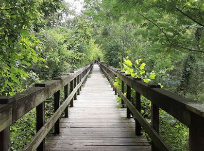
PLOT SUMMARY: Lee’s Loop is 1.8 miles and circles through the Jackson Hill Trail System. The trailhead sign with a system map marks the start of the trail, just beside the parking lot on Jackson Hill. The undulating trail is alm…
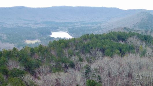
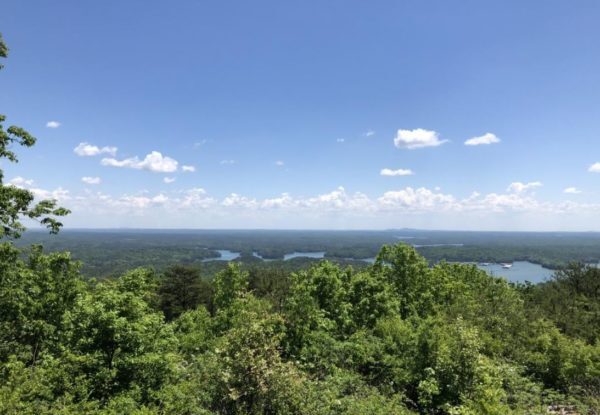
PLOT SUMMARY: This easy trail begins with one of the best views of the “Ridge and Valley” section of Northwest Georgia from the deck in the parking lot. The trail takes you on a high ridge of Johns Mountain to an overlook of Keo…
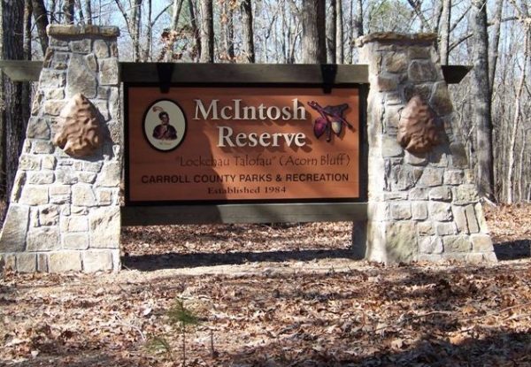
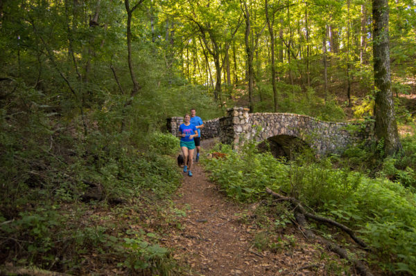
PLOT SUMMARY: The Reserve is 527 acres packed with history, trails, pavilions, splash park, and sweeping frontage on the Chattahoochee River. The Creek Indian heritage and beautiful outdoors give hikers a memorable experience.
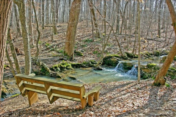
PLOT SUMMARY: This trail follows the old road to the Marble Mine, one of the James H. "Sloppy" Floyd State Park's most scenic features. The spring and winter rainfall generate …
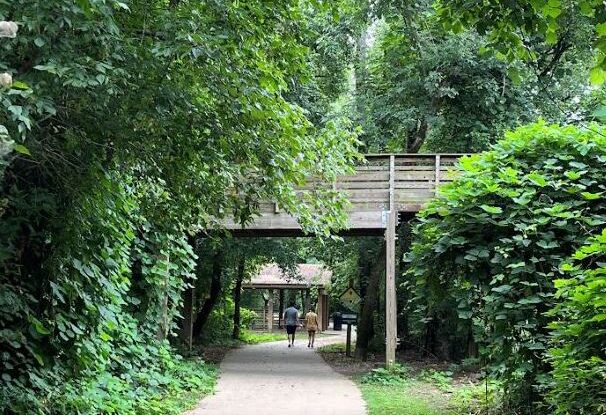
PLOT SUMMARY: The trailhead is located in Downtown Woodstock with easy access to a dog park and connects to other trails. Downtown shopping and dining is located within a 2 minute walk from the trail. The City of Woodstock/Woods…
PLOT SUMMARY: Hike one or more of the seven trails on this state historic site as you learn the historic significance surrounding the events that took place during the American…
PLOT SUMMARY: There are two loops connecting Pine Mountain: East Loop & West Loop. This is a rugged and challenging hike reaching 1,562 feet above sea level. The trail is open daily for hiking. At the summitt enjoy beautiful…
PLOT SUMMARY: A 483-acre park with over 5 miles of walking trails through open valley fields and mixed pine/hardwood forest with streams and wetlands. The site is dedicated as a heritage preserve to conserve and protect the cult…
PLOT SUMMARY: Start at the Ringgold Nature Trail that joins the Chief Richard Taylor Trail for a round trip walk of a nice and easy paved trail, the trails leads through the western section of the Ringgold Recreational Complex a…
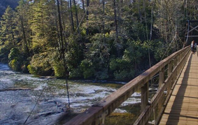
PLOT SUMMARY: A popular destination for day-hikers, Benton MacKaye Trail thru-hikers, and paddlers making the journey down the Toccoa River Canoe Trail is the swinging bridge over the Toccoa River. This 270 foot long bridge is t…
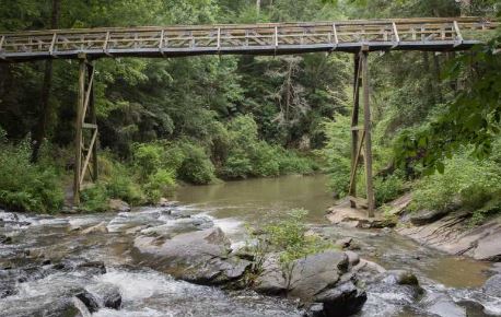
PLOT SUMMARY: In just over a mile there are several scenic stops to enjoy including a 150ft bridge crossing 30 feet over Tails Creek, ending at the cascade’s peak. Be sure to walk the other part of the trail that leads to an ove…
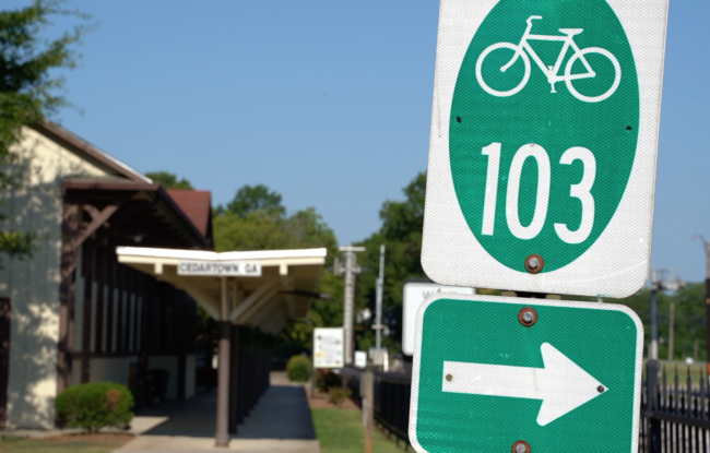
The perfect first stop on your trip to Cedartown is the Welcome Center located downtown just off the Silver Comet Trail. The popular cycling trail is marked in dark green on our maps and runs. 61.5 miles from Smyrna, GA to Alabama. The …
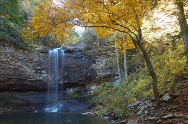
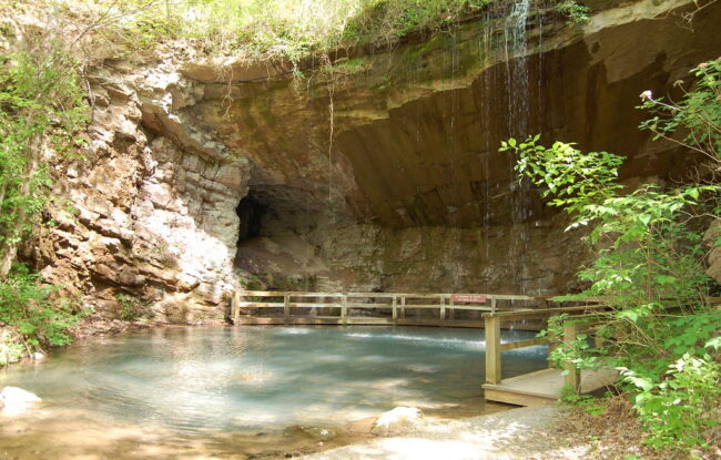
PLOT SUMMARY: 600 steps down into the canyon take you to two impressive waterfalls. That’s the easy part. The hike back to the top of the rim take a little more muscle. But the steps make it easier to stop and rest if needed. View Website
Location: Trenton/Rising Fawn (Dade County)
Trail Length: 1.5 Miles
Difficulty: Moderate to Strenuous …