


Directions
Get directions between your address/position and any location on the map. Show locations within a specific distance of your location/address. Display routes and the directions steps.
Choose a starting point
Enter an address or

geolocate your position.
1.
Click to activate/deactivate the distance search.
2. (When activated) Use the slider to define the size of the search area.
3. Click on the button

to search.


Switch the travel mode.


Click on the marker popup to render the route and the directions steps.
 Directions
Click to toggle the directions steps widget.

Click to hide the directions steps widget.
Click to remove the currently displayed route and the directions steps widget.

Click to reverse the start point and the destination. This will update the route and the directions steps.

Click to center the map on your starting point.
Reset
Click to reset and search from scratch.
Submit location

Loading

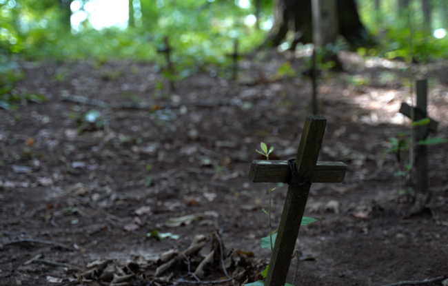

PLOT SUMMARY: This one-acre cemetery between the Euharlee Presbyterian and Euharlee Baptist Chur…
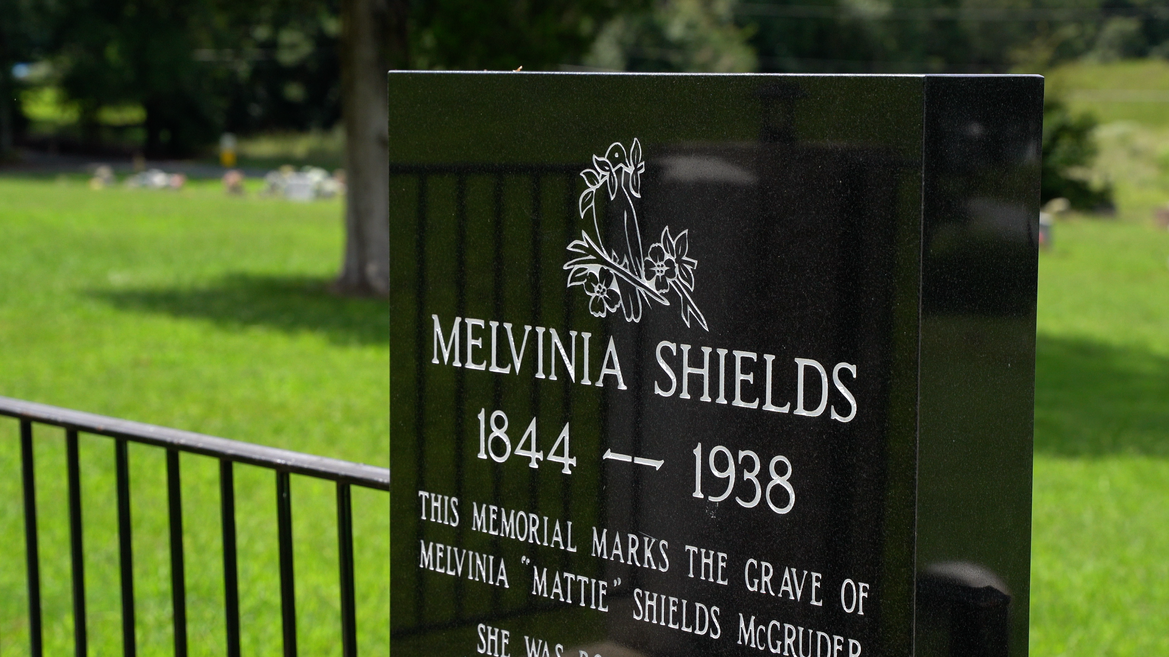
PLOT SUMMARY: The great-great-grandmother of Michelle Obama was laid to rest in 1938 in Kingston, Georgia. The legacy of the First Lady's ancestor was recounted in a

PLOT SUMMARY: The Coca-Cola Company has authenticated this mural on the side of Young Brothers Pharmacy in downtown Cartersville and declared it the first of its kind. The now iconic mural was painted in 1894 in hopes …
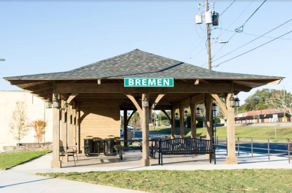
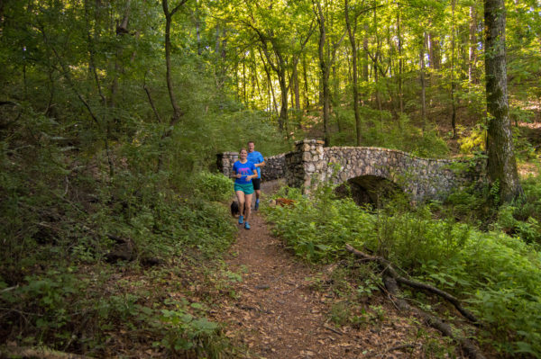
PLOT SUMMARY: A one mile walking tour for your health and history begins at City Hall. You will pass the Sewell Mill Textile Museum, and then continue around to some of the oldest homes still standing in Bremen. Bremen is also p…
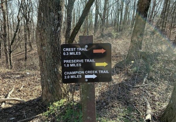
PLOT SUMMARY: This 900-acre preserve trail begins at 2500 ft elevation on Burnt Mountain. Two trails give the option of a short or longer hike. Parts of the trail follow old road beds. Seasonal flowers and interpretive signs hel…

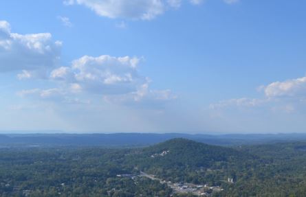
PLOT SUMMARY: The Stone Tower Loop is an uphill hike to the West Overlook Trail and returns on the CCC Stone Tower Trail. Enjoy year-round vistas from West Overlook and natural rock gardens. Several nearby trails are located in …
PLOT SUMMARY: Located off Highway 41, behind the Nazarene Church and State Patrol Barracks, the trail is named for the grave of George Disney who was buried atop Rocky Face Ridge. The Disney Trail is noted as being one of the mo…
PLOT SUMMARY: Lee’s Loop is 1.8 miles and circles through the Jackson Hill Trail System. The trailhead sign with a system map marks the start of the trail, just beside the parking lot on Jackson Hill. The undulating trail is alm…
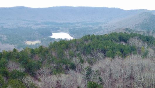
PLOT SUMMARY: This easy trail begins with one of the best views of the “Ridge and Valley” section of Northwest Georgia from the deck in the parking lot. The trail takes you on a high ridge of Johns Mountain to an overlook of Keo…
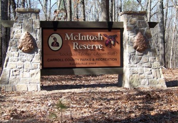
PLOT SUMMARY: The Reserve is 527 acres packed with history, trails, pavilions, splash park, and sweeping frontage on the Chattahoochee River. The Creek Indian heritage and beautiful outdoors give hikers a memorable experience.

